Tidal modelling
JM Coastal specialises in developing robust and accurate tidal models calibrated to tide gauge observations.
Tides are the continuous rise and fall in sea level caused by the gravitational force of the Moon, the Sun and the rotation of the Earth. This effect is amplified on the continental shelf so that many coastal regions experience large sea level variations which are the dominant driver of coastal processes.
Coastal processes affected by the tide include:
- Wave height at the coast
- Estuarine mixing and pollutant dispersal
- Sediment transport patterns
- Channel navigation and shipping
- Storm surge generation and coastal elevation
The tides are a predictable phenomena and any coastal or estuarine modelling study in a region of significant tidal range should inlude an accurate and well calibrated tidal model as standard. We can use a range of modelling tools and software such as TELEMAC-2D and MIKE21FM, and utilise bathymetric data and available observations to build robust tidal models.
North Sea Tide Model
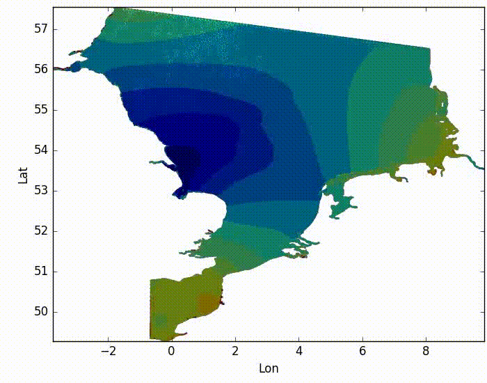
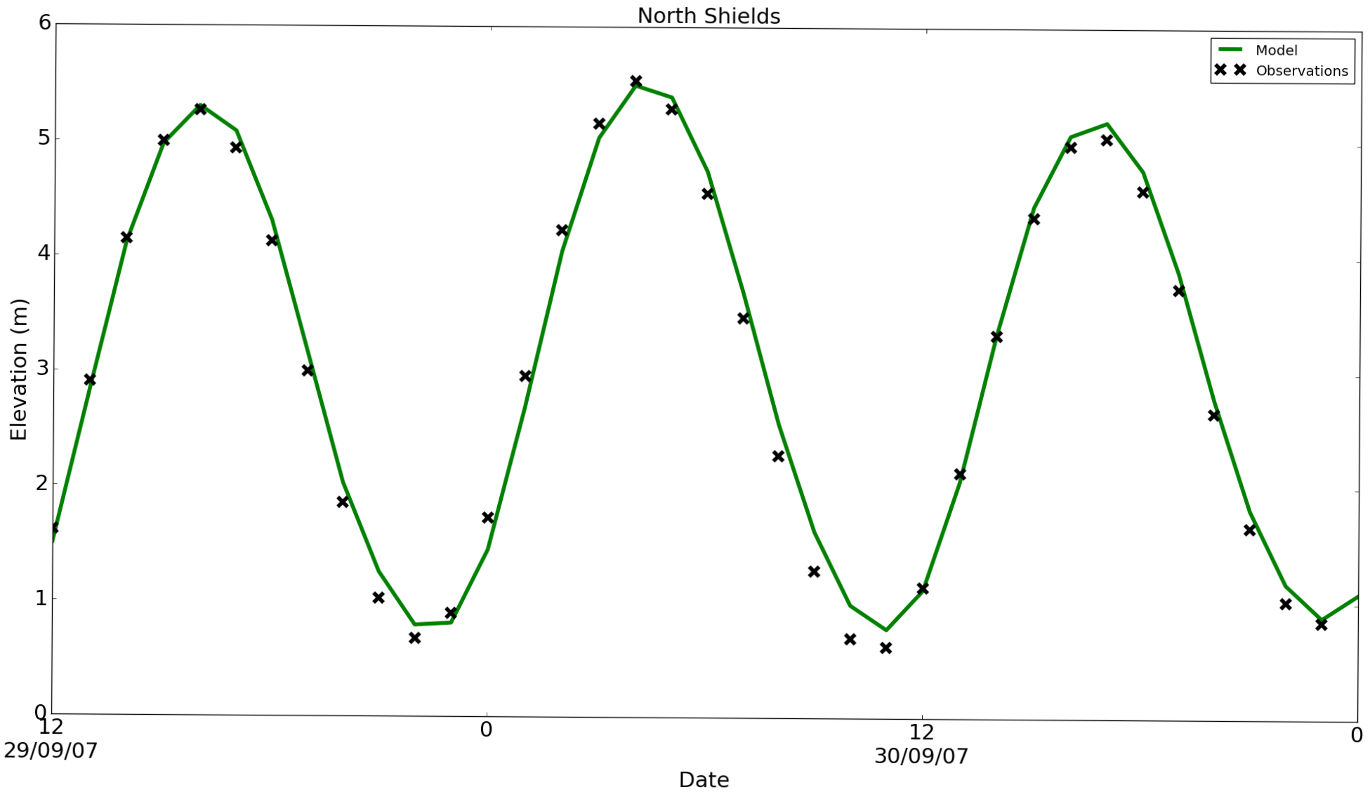
Our North Sea tidal model is built using TELEMAC-2D. The model utilises EMODnet bathymetry and takes advantage of a global database of tidal constituents derived from satellite altimetry to force the model. The model is calibrated to tide gauge observations to provide an accurate solution. Models such as this can be implemented in any region at a resolution and accuracy that is specific to the needs of the end user. Read more about the North Sea model and the Irish Sea model.
For information on the development and use of tide models please get in touch: john.maskell@jmcoastal.co.uk